For drawings & CAD
Take vector linework into your drawing tools, or export a plan to review and share. Choose A4/A3 and 1:20, 1:50 or 1:100 for a scaled PDF.
SVG · DXF · PDF · PNGCreate an editable floor plan or a textured 3D model with your iPhone. Review the space and share your files.
LiDAR-equipped iPhone · iOS 17+
A readable layout or a closer look at the surfaces. Choose the output you need. The plan and textured model use separate captures.
For layout & dimensions
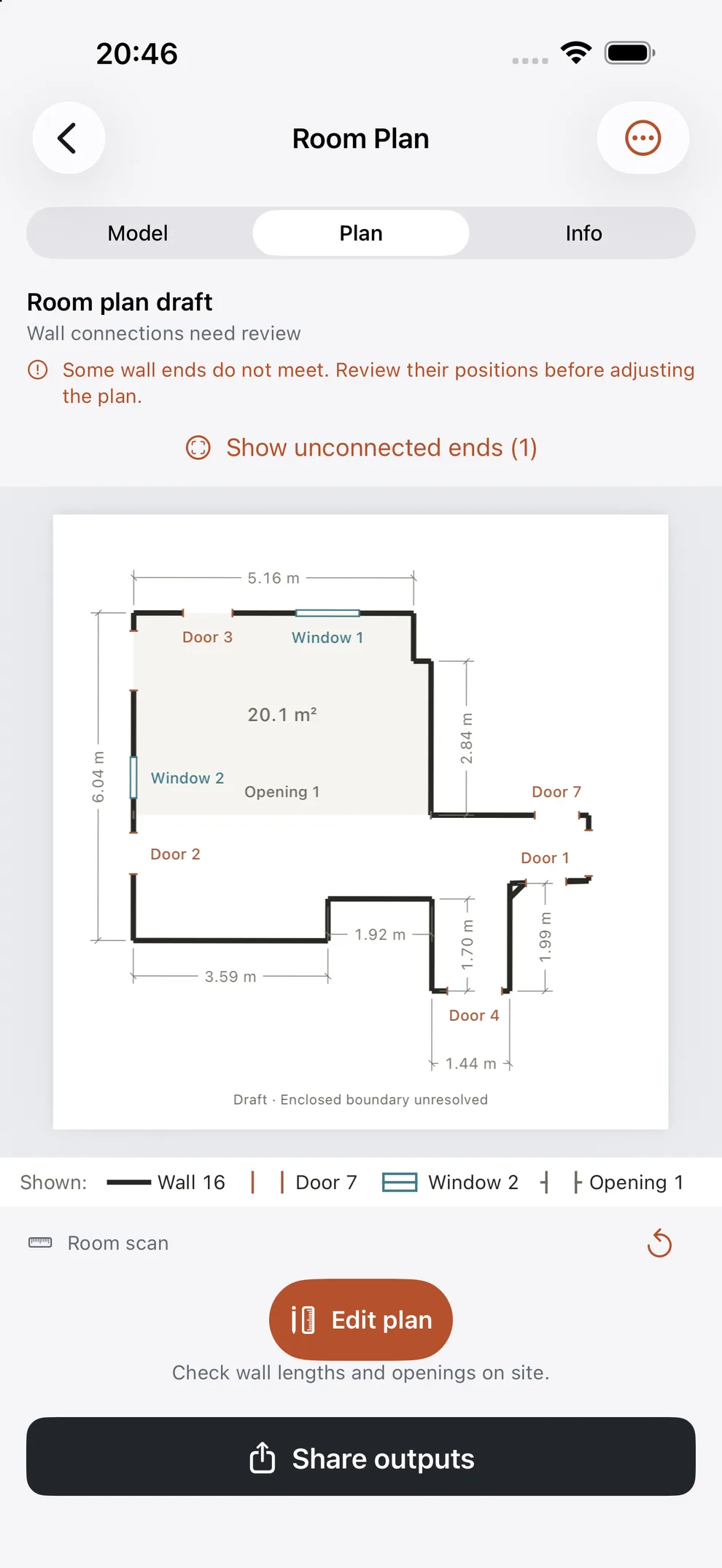
Capture walls, doors and windows as a 2D plan. Correct the geometry and take a clear outline into your design work.
Show each corner and the full opening frames.
For surfaces & spatial reference
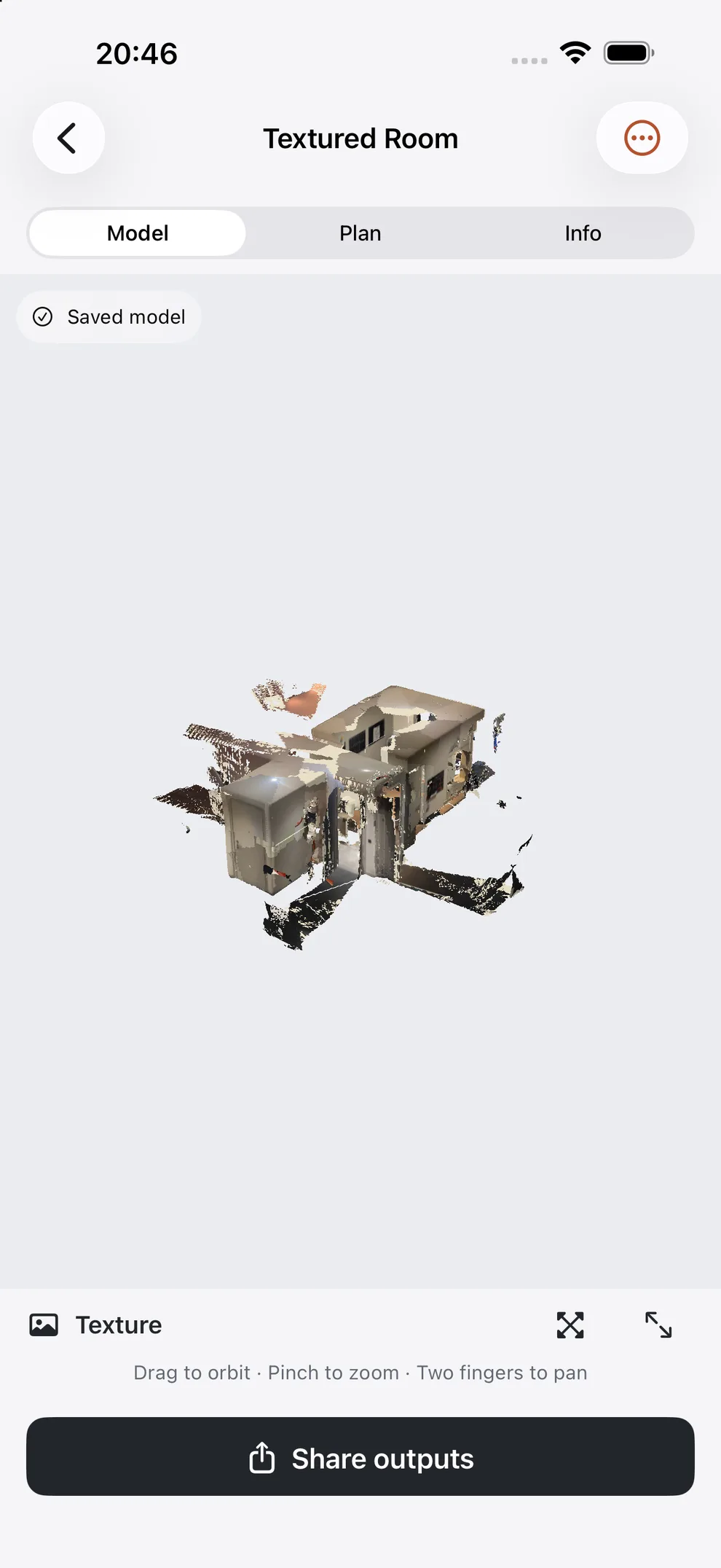
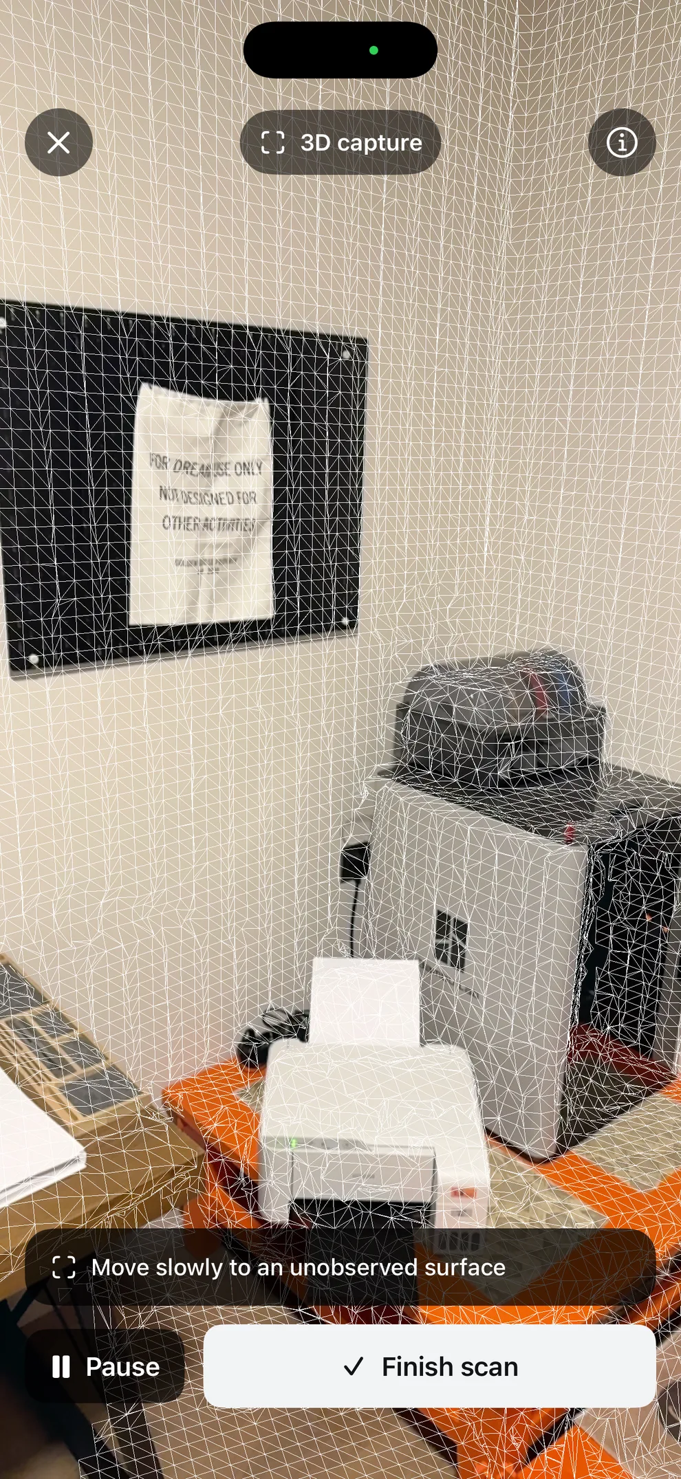
Record surface geometry and photographic texture. Revisit the space from another angle after you leave the site.
Move slowly and revisit gaps from another angle.
Actual app screens: floor-plan result and textured capture. Each mode uses its own scan.
Bring walls, doors, windows and openings into a plan you can work with. Review estimated dimensions and uncertain connections, then make the corrections you need.
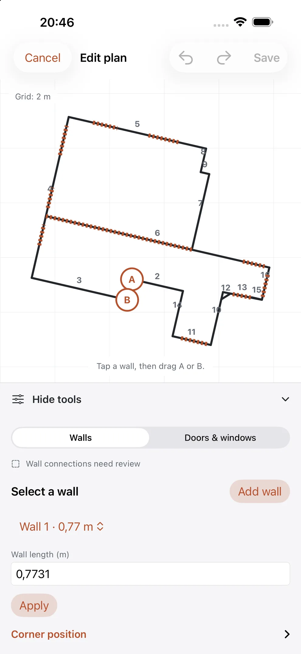
Work in metres or feet. Save edits separately from the original capture.
Actual editor screenshot. The controls here explain the tools; edit your own plan in the iPhone app.
Rotate and zoom on your iPhone. Switch between texture, surface and Mesh, then share the model as GLB or USDZ.
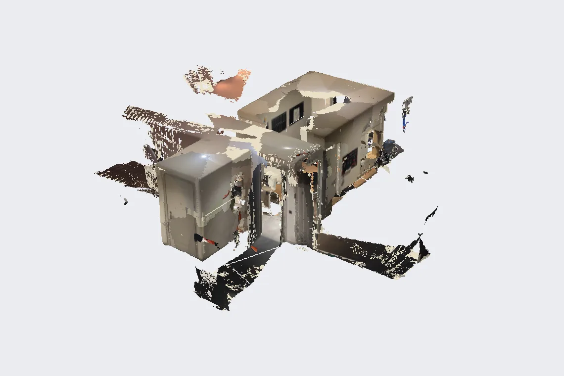
Review texture, shape and Mesh in the iPhone app.
Actual model preview in SpaceCraft.
Keep useful files, not just a preview. Choose the outputs for your project and keep a separate backup when the work matters.
Take vector linework into your drawing tools, or export a plan to review and share. Choose A4/A3 and 1:20, 1:50 or 1:100 for a scaled PDF.
SVG · DXF · PDF · PNGShare the available textured model as a spatial reference. A scan report PDF keeps available measurements and capture details with your files.
USDZ · GLBExport a project backup, with retained sources if you choose. Import it as a separate project, and revisit earlier saved versions in the app.
.spacecraftExports depend on the project: a plan-only project has no textured model. CAD coordinates use metres. Print scaled PDFs at 100% and verify dimensions before use.
For early design studies, renovation references and a closer look after a site visit. Measurements are estimates; check them before construction or ordering materials.
Start with a floor plan for layout, or a textured 3D model for a spatial reference. Each uses its own capture.
Move steadily, show the corners and revisit gaps. Review the result and check important dimensions on site.
Refine the plan, add project notes and share the files you need. Export a project backup to keep a separate copy.
Capture is processed on your iPhone and projects are stored locally. The optional iCloud library is off by default and stores private viewing copies separately from local projects. It excludes retained capture sources and version history; you choose where exports and full backups go.
Read the privacy policyFloor plans, textured models and editing tools for LiDAR-equipped iPhone. The first version is free, with no in-app purchases.
The iPhone release is being prepared for App Store submission. The first release will be free.
LiDAR iPhone · iOS 17+
Device support, editing, files and the limits of capture. Need a closer look at the workflow? The support guide goes into the details.Open the support guide
The first iPhone release is free, with no in-app purchases. Check the release status below for current availability.
A LiDAR-equipped iPhone with iOS 17 or later: iPhone 12 Pro / Pro Max or a later LiDAR-equipped Pro model.
No. Floor plan and textured 3D use separate captures. You can add a floor-plan pass to a model project; the two captures are not automatically aligned.
Plans export as PDF, PNG, SVG and DXF; available models as GLB or USDZ. You can also export a scan report and a .spacecraft project backup. A plan-only project has no textured model.
Dimensions and areas are estimates. Glass, mirrors, lighting and missing surfaces can affect capture. Check important dimensions on site before construction or ordering materials.